") Present-day continental crust, which typically has a thickness of 30–50 km, plus up to 150 km of rigid, cool, uppermost mantle that sticks to it as if it were crust. The word ‘crust’ means that the rock solidified from magma, from hot, liquid rock that cooled at or near the surface. In contrast to the Moon’s crust, it did not form all at once. However, estimates of how quickly it formed vary greatly. Much of the oldest crust ended up buried by sediments that were eroded from it (exposed areas of Archaean rock are rare) and is therefore difficult to quantify, while the various geochemical methods for reconstructing the crust’s areal growth history give widely differing results. Anything between 35% and 75% of the present crust is thought to have formed during the Archaean. Seismic data suggest that possibly 50% of the lithospheric mantle is Archaean (Griffin et al. 2008). Most of the crust that is Archaean seems to have formed after 3.5 Ga. Most of the rest formed during the subsequent Proterozoic (2.45-0.54 Ga). Sedimentary rocks make up only around 8% of the crust.
Present-day continental crust, which typically has a thickness of 30–50 km, plus up to 150 km of rigid, cool, uppermost mantle that sticks to it as if it were crust. The word ‘crust’ means that the rock solidified from magma, from hot, liquid rock that cooled at or near the surface. In contrast to the Moon’s crust, it did not form all at once. However, estimates of how quickly it formed vary greatly. Much of the oldest crust ended up buried by sediments that were eroded from it (exposed areas of Archaean rock are rare) and is therefore difficult to quantify, while the various geochemical methods for reconstructing the crust’s areal growth history give widely differing results. Anything between 35% and 75% of the present crust is thought to have formed during the Archaean. Seismic data suggest that possibly 50% of the lithospheric mantle is Archaean (Griffin et al. 2008). Most of the crust that is Archaean seems to have formed after 3.5 Ga. Most of the rest formed during the subsequent Proterozoic (2.45-0.54 Ga). Sedimentary rocks make up only around 8% of the crust.
- igneous rocks
- chemically precipitated sediments, such as salts, cherts and limestones (the latter increasingly composed of tiny organic shells, but not until after the Proterozoic)
- clastic sediments, such as clays, sandstones and conglomerates, the erosional detritus of older igneous and chemical rocks.
 The most common igneous rock is basalt, because this is the composition of oceanic crust, which is around 7 km thick on average and covers 70% of the Earth. The ocean crust is relatively young, because it is continually being renewed at mid-ocean ridges, from where it spreads outwards. Consequently, the Atlantic Ocean is gradually widening. To compensate, ocean crust around the margins of the Pacific and some other places is continually being subducted. At that point, the spreading slab ceases to be horizontal and descends beneath the less dense continental crust, returning to the mantle from which it came. This, in essence, is what is meant by plate tectonics.
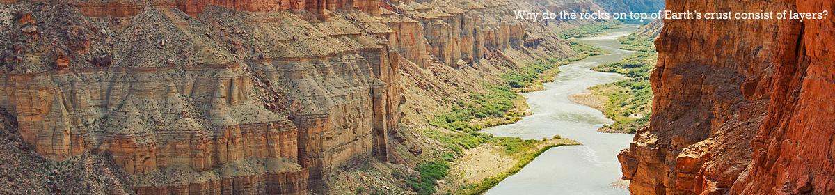
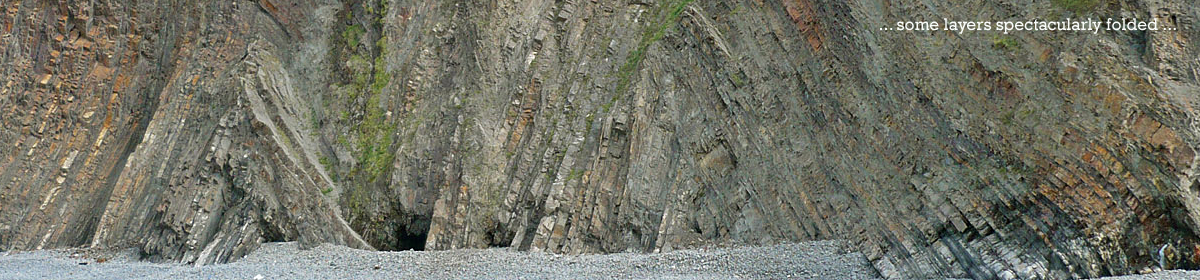
Continental crust comprises a mixture of rocks. By far the most common are granites, coarse-grained igneous rocks that form at relatively low temperature within the crust. Clastic, sedimentary rocks constitute only a minor proportion of the total but are common after the Archaean at the top of continental crust. They occur most voluminously in areas of uplift, where weathering, landslides and tectonic dislocations erode the mountains and distribute the product across low-lying plains and basins. The most common sediments are mudrocks, such as shales. When rocks are subjected to intense heat or pressure, they recrystallise and/or their mineral composition changes, in a process known as metamorphism. Among the more familiar types of metamorphic rock are marble (metamorphosed limestone) and slate (metamorphosed mudstone).
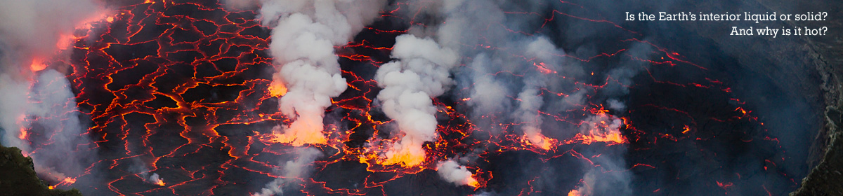
The oldest parts of the continents are up-to-100-km-thick blocks called cratons. Seismic tomography, a technique for imaging the subsurface with seismic waves produced by earthquakes or artificial explosions, reveals that the cratons have deep, relatively cool mantle roots or ‘keels’ extending down to 200–400 km. How the cratons came into being is not well understood, for they formed too late to have been the crystallised remnants of a ‘magma ocean’, such as once enveloped the Moon. The interpretation here is that they are the solidified remains of melt produced by the asteroids that struck the Earth in the Hadean period. Their kinetic energy, combined with the decompression following excavation of the huge craters, melted the underlying rock instantaneously, to the extent it was not already molten. Temperatures reached at least 1800° C.
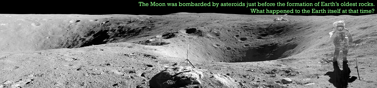
The same thing happened on the Moon (Elkins-Tanton et al. 2004), where the largest craters filled with upwelling basalt, visible as dark maria. The Earth’s 6x greater gravitational attraction should have rendered the bolides hitting its surface only more catastrophic. It is unlikely that the Earth would have retained no trace of the impacts. Below the Earth’s surface there were also large reservoirs of water, and in the wake of the impacts some of the superheated water mixed with the melted basalt. As the heavier more refractory minerals separated out from the melt, residues of buoyant silica-rich granite pooled below the impact sites and elevated them above the surrounding lithosphere. The flood waters drained away not by seeping back underground but by collecting into basins. As the spreading rate of hot new ocean crust gradually decreased, the basins cooled and deepened, becoming the floor of oceans. Analysis of the oxygen-isotope ratios of oceanic sediments according to age shows that the oceans were still cooling during the Mesozoic and Cenozoic. They did not attain their present depth until late in the Cenozoic – on the conventional timescale almost 4 billion years later.
Around 40–50 cratons have been counted, of which only small fractions expose rocks older than 3.5 Ga. No parts are older than 4.0 Ma. However, because the rock-forming magmas took time to cool, most ages understate the time of origin. Rocks dated to 3.9–3.8 Ga occur in southwestern Greenland, northern Labrador, northeastern Canada, eastern Antarctica and central China. For comparison, the period when lunar mare volcanism was at its most voluminous, according to a chronological scheme based on crater counts, was between 3.8 and 3.6 Ga (Hiesinger et al. 2011). Occasionally cratons collided and amalgamated to form larger units. The Kaapvaal craton, for example, collided c. 2.0 Ga with the Zimbabwe craton.
Plate tectonics is fundamental to understanding how continents formed, so when and how the Earth’s surface divided into mobile plates are crucial questions. Three conditions are requisite: the mantle near the surface needed to be molten, the lithosphere needed to be thin enough for magma to erupt, and there needed to be copious water to lubricate the sliding of one plate under another. These conditions all came about during the Archaean, some time after asteroids had fractured the lithosphere. In the new ocean basins huge volumes of magma surged through the fractures to generate new ocean crust. The laterally spreading lithosphere then pushed the basins against the cratons, and since the junction between the two was a zone of weakness, the denser lithosphere began to subduct, lubricated by water leaking from what remained of the primeval deep. The submerged and pulverised antediluvian world sank into the underworld.
Aided by topographic irregularities and by lateral pressure from the emergent cratons, subduction zones also developed between the oceanic plates. As slabs descended into the mantle and heated up, they lost some of the water trapped in their regolith. The rising water then acted like a flux to lower the melting temperature of the rock above, causing large volumes of magma to erupt and form volcanic arcs, rather like the Tonga Islands where the Pacific plate subducts beneath the Indo-Australian plate. In this manner oceanic lithosphere was converted into continental lithosphere, the islands riding with the plates and accreting against the cratons.
Exactly when accretionary plate tectonics began on Earth is still debated: some geologists argue for 4.0 Ga, right at the beginning of the Archaean, others not until 3.2 Ga or later. The debate is essentially about how the cratons formed. Can they be explained by the same kind of accretionary growth as explains the growth of most new crust after the Archaean, or were they generated by what is called vertical, plume tectonics? Not all are easily understood in terms of the latter. The Kaapvaal craton, for instance, has been interpreted as a collage of ocean plate fragments that stacked one on top of the other as plates collided. Alternatively, the 3.5–3.2 Ga continental nucleus may have formed as a thick volcanic plateau, not unlike Iceland, on older mainly granitic crust (van Kranendonk et al. 2015).
Whatever regime predominated, Archaean rocks reflect mostly catastrophic conditions. The Archaean was a more violent time than any other in Earth history, and was dominated by igneous processes. Some tracts underwent complex folding. On a gross scale, however, the geology is relatively simple. Most characteristic are the belts of granite and metamorphosed iron- and magnesium-rich volcanic rocks known as ‘greenstones’. Later in the Archaean, clastic sediments collected in low-lying areas on and around the cratons.
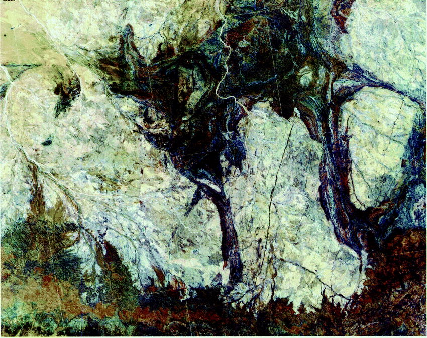 As the granitic basement solidified, lavas surged up through fissures to lay down thick underwater tracts of komatiite. The iron in their minerals gives them a greenish appearance. They can be up to 20 km thick, as in the Pilbara craton of northwest Australia. Typically they comprise a lower, dominantly igneous group and an upper, dominantly sedimentary group. The sediments consist of hydrothermal cherts and banded iron-formations (alternating precipitates of iron oxide and silica), followed by shales, sandstones and conglomerates – eroded volcanics that were rapidly re-deposited as clastics. Greenstone belts also often contain ore deposits of gold, silver, copper, zinc and lead, injected into the crust by metal-saturated fluids.
Komatiites, named after outcrops along the Komati River of the Kaapvaal craton, are almost unique to the Archaean. Being exceptionally rich in magnesium, they have melting points 400–500° higher than that of basalt. Some of them indicate mantle temperatures as high as 1950 °C. The mantle regions sourcing the lava were substantially hotter than the upper mantle today and were mostly dry. As the Archaean progressed, the proportion of magnesium in the magmas contributing to the upper crust decreased. Either the whole mantle was already cooling, or the source regions were the dry parts of the subcratonic mantle that was anomalously hot because of the impacts and these cooled through the Archaean.
- catastrophic volcanism gradually abated
- depositional gradients steepened as cratons became increasingly emergent
- erosion and sediment recycling became dominant.
Both during and after deposition, the greenstone successions were intruded by huge granitic domes or batholiths, up to 100 km across. Inflating blobs of low-density magma rose through the still soft greenstones and shouldered them aside. By the mid to late Archaean some may have reached all the way to the surface; others were exhumed in the Proterozoic and later. The ascending granites transferred with them a significant proportion of heat-producing elements, enabling the mantle beneath to cool and stiffen.
Much of the current volume of Earth’s continental crust had formed by the end of the Archaean, through melting of hydrated basaltic rocks at depths of approximately 25–50 kilometres, forming sodic [sodium-rich] granites of the tonalite–trondhjemite–granodiorite (TTG) suite. However, the geodynamic setting and processes involved are debated, with fundamental questions arising, such as how and from where the required water was added to deep-crustal TTG source regions.
Smithies and co-authors identify less sodic TTGs, reflecting source rocks that were hydrated from both mantle water and water at the surface, and strongly sodic TTGs, reflecting source rocks that were hydrated solely from mantle water. They rule out the possibility that the water was introduced into the mantle by subduction. As with komatiites, which became less-Mg rich through the Archaean, TTGs became less Na-rich through the period and thereby approached the composition of more normal granites, derived partly from the remelting of pre-existing crust.
Continental crust continued to be generated and cratons to amalgamate in the late Archaean. As their interiors stabilised, widespread sedimentary platforms and basins developed, showing that continental crust had attained sufficient rigidity to sustain sedimentary piles kilometres thick.
North-west Canada’s Slave craton – an amalgamation of two cratons that collided c. 2.6 Ga – is fairly typical. The figure shows a summary of the sequence in the central region. The basement, primarily granitic and dating to 4.0–2.83 Ga, includes the oldest crustal fragment on Earth, the Acasta Gneiss. The Acasta Gneiss consists of metamorphosed granites ranging in ages from 4.0 to 3.4 Ga; most of the complex is less than 3.5 Ga. Above the basement an erosive horizon or unconformity marks a time gap, beginning 2.83 Ga, when the craton was above water. Above it a fining-upward succession of sedimentary rocks, from conglomerates to sandstones to shale, reflects the later stages of erosion when the area gradually subsided. The source of the deposits must still have been above water. Then follow submarine pillow and massive basalts up to 6 km thick, dated to 2.73–2.70 Ga (as on many other cratons), and a minor unconformity as igneous activity became subaerial. Earth tremors triggered mass transport of sediments which ended up as turbidites, possibly as the craton collided with another land mass to the east. Part of the craton was folded into mountains and intruded by granitic domes. The conglomerates, finally, record unroofing of these transient mountains.

Comparable stratigraphies are observed in other places, such as the Dharwar (southern India), Zimbabwe, Wyoming cratons and parts of the Yilgarn craton (western Australia).
the pronounced flattening of Archean pillows, the very intricate fit of one pillow into the irregularities of adjacent pillows, and the presence of ghost selvages between two or more pillows all indicate that the Archean pillows are compressed together while still very hot and plastic, implying rapid accumulation, compression, and outward spreading of the flow. (Wells et al. 1979)
Even if we halved the timespan to allow for intervals of erosion and non-deposition, the average rate of accumulation would still be only 0.06 mm per year: less than the thickness of a sheet of paper. Archaean geology is incompatible with the dates produced by radioisotope dating. While it may not be possible to say exactly how long the period occupies, it seems more fitting to think in terms of thousands of years than of billions.